

-
Recent Posts
- 2020 Bizarre Weather: Could two hurricanes collide? Here’s what may happen if Laura and Marco meet up in the Gulf
- 2020 Bizarre Weather: Six waterspouts filmed swirling at once in Gulf of Mexico
- Space Watch: Asteroid predicted to pass close to Earth the day before the presidential election
- On Aug 16, a car-sized asteroid flew within 2,000 miles of Earth, the closest ever recorded, and NASA missed it
- 500 Wildfires Raging: Three California wildfires now rank among largest in state’s history, and they are still growing
Facebook
Donate – Support the site

-
Join 12K other subscribers
EP: Live Twitter Feed
Tweets by ExtinctionpArchives
- August 2020
- July 2020
- June 2020
- May 2020
- April 2020
- March 2020
- February 2020
- February 2017
- November 2016
- October 2016
- September 2016
- August 2016
- July 2016
- June 2016
- May 2016
- April 2016
- February 2016
- January 2016
- December 2015
- November 2015
- October 2015
- September 2015
- August 2015
- July 2015
- June 2015
- May 2015
- April 2015
- March 2015
- February 2015
- January 2015
- November 2014
- October 2014
- September 2014
- August 2014
- July 2014
- June 2014
- May 2014
- April 2014
- March 2014
- February 2014
- January 2014
- December 2013
- November 2013
- October 2013
- September 2013
- August 2013
- July 2013
- June 2013
- May 2013
- April 2013
- March 2013
- February 2013
- January 2013
- December 2012
- November 2012
- October 2012
- September 2012
- August 2012
- July 2012
- June 2012
- May 2012
- April 2012
- March 2012
- February 2012
- January 2012
- December 2011
- November 2011
- October 2011
- September 2011
- August 2011
- July 2011
- June 2011
- May 2011
- April 2011
- March 2011
- February 2011
- January 2011
- December 2010
Categories
- * Publisher Coupon Discount
- 1 Submit story
- 11:11 signature encoded
- 2012
- Acquatic Ecosystem crash
- Animal Extinction
- Apostasy
- Avalanche
- Black hole or supernova
- Black Swan Event
- Blizzard
- Breaking News Event
- Catastrophic Insurance losses mount
- Celebrities and the Apocalypse
- Chemical explosion
- Chemical Pollution
- Civilizations unraveling
- Climate unraveling
- Cloudburst storms with flashflooding
- Coal Seam Fire
- Comets
- Commentary
- Cosmic and Gamma Ray emissions
- Cracks
- Crowd Control technology
- Cryometeor
- Cyber Warfare
- Cyclone or Hurricane
- Dark Ages
- Deep Focus earthquake
- Deluge from torrential rains
- Derecho storm
- Derecho storm system
- Desertification
- Disappearing Lakes
- Disaster-related suicides
- Disease outbreak
- Dormant fault activation
- Dream Portal TEP
- Drought
- Drumbeat of War
- Dust Storm
- Earth Changes
- Earth Watch
- Earth's core dynamics
- Earthquake Omens?
- Eclipse
- Ecology overturn
- Economic upheaval, social unrest, terrorism
- Ecoystem crisis due to population boom
- Editor's note to readers – policy
- El Nino Effect
- Electric power disruption & grid failure
- Electronic Surveillence
- Emerging disease threat
- Environmental Threat
- Erratic Jet Stream
- Ethnic or religious strife
- Extinction Protocol Exclusive Editorial
- Extinction Threat
- Extreme Weather Event
- Famine Threat
- Financial System Collapse
- Fireballs
- Fireballs, Meteor or Asteroid
- Flooding
- Food chain unraveling
- Forecast book quotation
- Fracking quake suspected
- Frost Quakes
- Fungus outbreak
- Future coding
- Futuristic tech trends
- Gale-force winds and gusts
- Geomagnetic Storm Alert
- Geyser eruption
- Giant Earth Crack
- Glacial fracture
- Glacial Melt
- Global Debt Bomb
- Ground inflation
- Hailstorm
- Harmonic tremor swarm
- Hazardous chemical exposure
- Health guideliness issued
- Heatwave
- Helium Seepage
- High-risk potential hazard zone
- Hum noise
- Human behavioral change after disaster
- Human Migration
- Ice Storm
- Infrastructure collapse
- Invasive species threat
- Islands sinking
- Lack of snow
- Land fissures
- Land fissures, cracks, sinkholes
- Landslide & geological deformation
- Lava flow
- Lightning storm
- Limnic overturn
- Lithosphere collapse & fisssure
- Lurid acts of violence increasing
- Magma Plume activity
- Magnetic pole migration
- Marine animal strandings
- Martial Law
- Mass animal deaths
- Meteor or Asteroid
- Methane Seepage
- Monthly lead post
- Mud volcano
- Mudslide
- Mystery Boom & Shaking
- Natural gas explosion
- New Book
- New land rises from sea
- New virus reported
- New volcanic activity
- New weapons of war
- New World Order -Dystopia- War
- Nuclear plant crisis
- Ocean overturn
- Ozone Hole
- Pack Animal Aggression
- Pest Explosions
- Pestilence Watch
- Planetary discovery
- Planetary Tremor Event
- Polar Vortex
- Poleshift risks
- Pollution and Waste
- Potential Earthchange hotspot
- Prophecies referenced
- Quarantine
- Radiation leak or contamination
- Rare snowfall
- Reality Check
- Record Cold temperatures
- Record high temperatures
- Record rainfall
- Record snowfall
- Red Tide
- Resource war
- Rising tension between nations
- Rumors of War
- Scientific blunders
- Seismic tremors
- Signs of Magnetic Field weakening
- sinkholes
- Social unrest
- Solar Event
- Space Watch
- Strange high tides & freak waves
- Strange unexplained noises
- Subglacial flood event
- Submarine volcanic eruption
- Submarine Volcano
- Supermoon
- Supervolcano News
- Tectonic plate movement
- Time – Event Acceleration
- Time Portals
- Tornado Outbreak
- Tsunami
- Unknown phenomena in the sky
- Unprecedented Flooding
- Unseasonable Weather Event
- Unsolved Mystery
- Unusual hail storm
- Unusual solar behavior
- Ususual animal behavior for disaster
- Volcanic Ash
- Volcanic Eruption
- Volcanic gas emissions
- Volcano unrest
- Volcano Watch
- Water Crisis – Conflict
- Wildfires
Books by the Author
News website
Support
Youtube Channel
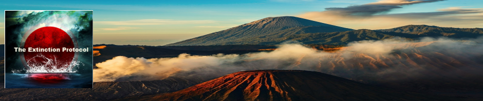
Magma Plume Activity: eruptions in Canary Islands, Azores shaken by 4.7 magnitude quake
This entry was posted in Earth Changes, Earth Watch, Earthquake Omens?, High-risk potential hazard zone, Lithosphere collapse & fisssure, Potential Earthchange hotspot, Seismic tremors, Volcanic Eruption, Volcano Watch. Bookmark the permalink.


I guess it’s semantics, but any new land created 200 feet from shore would be part of the old island? Or if not immediately a part, it would eventually form a part, just as the two volcanic poles
of Maui formed one island with a valley between. A valley 200 feet wide would be much less than the valley of Maui, which is wide enough to house a Maui’s capitol town and many cane fields and
several seaside resorts.
LikeLike
I’m trying to understand how the Spanish authorities can “insist there is no major risk for the population” when there’s toxic gases spewing into the air? Maybe it’s just me, but I would be more concerned about the toxic gases than the volcano or the seismic activity.
Maranatha
LikeLike
Sharp increase in eruption activity from El Hierro volcano
Posted on November 14, 2011 by Jón Frímann
This is a short update on El Hierro volcano.
There has been a increase in harmonic tremor activity from El Hierro volcano. This suggest that new vent or vents might be opening up in El Hierro volcano. But this type of eruption pattern is to be expected from a fissure eruption. Like the one that is currently taking place in El Hierro volcano.
There are also some explosions that can be seen on this tremor chart. But they form spikes that can be spotted if looked closely. Is is now also possible to monitor the eruption via web cam located on El Hierro Island. That web cam can be found here.
http://www.jonfr.com/volcano/?p=1781
LikeLike
Reports of strong sulfur smell in the Naos Mountains. Where are they on Hierro? Does an eruption start on land maybe? http://earthquake-report.com/2011/09/25/el-hierro-canary-islands-spain-volcanic-risk-alert-increased-to-yellow/
LikeLike
I don’t see them on any topography map of the El Hierro region.
LikeLike
Alvin, I don’t notice the plume at Bolivia even being shown, Or is it just to small to be considered a plume? Also Isn’t one of the volcanos near goma in Africa, supposed to be one of the hottest (magma temps) due to being on a deep plume?
LikeLike
Something, I’ll look into.
LikeLike
Mt. St. Helens erupted in a flank scenario after just a 5.1 quake. Looks like Canaries is on the brink of three possible eruptions, submarine, El Hierro, and La Palma.
LikeLike
Underwater eruptions negate the explosive effects of an above sea volcanic eruption due to water pressure. If this volcano is 200 feet underwater and breaking the surface of the water then this is quite an explosive event.
Does anybody know how much lava is being emitted, and, how long, (at the volcanoes current eruptive rate), until the peak of the volcano fills the 200 feet void between it, and the surface of the ocean?
If the eruptions are still as violent as they are today, then, that event will be a very precarious one. That is when the true magnitude of this eruption and the effect on local residents will be truly known.
My thoughts and best wishes are with the Canary Islanders.
LikeLike
I think they need to get everyone out of there…before it’s too late… Just sayin’
LikeLike
LikeLike
Report of November 13 of Ramon Margalef. http://www.ieo.es/apartar/ieoprensa/hierro/131111.pdf seems to have been a landslide and now there are two blocks (the volcanic cone and a block).
LikeLike
c/o
Magnitude mb 4.7
Region AZORES ISLANDS, PORTUGAL
Date time 2011-11-14 11:34:57.0 UTC
Location 39.79 N ; 29.40 W
Depth 10 km
Distances 1735 km W Queluz (pop 103,399 ; local time 11:34:57.4 2011-11-14)
226 km NW Angra (pop 12,045 ; local time 10:34:57.4 2011-11-14)
148 km NW Lagoa (pop 9,239 ; local time 10:34:57.4 2011-11-14)
LikeLike
Alvin I do not see (maybe I am looking in the wrong place???) a button/link to contact you
Having said that I want to pass this along FYI and comment please, regarding a nuclear waste dump off El Heiro (among other placed in the oceans)
http://www.youtube.com/watch?v=paMrV7ej748 AND ALSO some other links which maybe of interest to you and readers.
Multiple nuclear waste sites, and sunken nuclear subs located between El Hierro and US East Coast! VERIFIED thru IAEA report.
PDF IAEA:
Click to access 31404684750.pdf
Tenerife German Traveloque article:
http://translate.google.com/translate?hl=de&ie=UTF8&prev=_t&sl=de…
Tsunami animation:
Decay rates change due to sun activity:
http://io9.com/5619954/the-sun-is-changing-the-rate-of-radioactive-decay-and-…
Another decay rates article:
http://www.symmetrymagazine.org/breaking/2010/08/23/the-strange-case-of-solar-flares-and-radioactive-elements/
Coast To Coast Report
LikeLike
Not familiar with thsi but something I’ll look into… Thanks
LikeLike
What kind of warning will East Coast of U S have if the Volcano collapses in the sea? How far in the coast would a Tsunami reach?
LikeLike
If there is a large flank collapse on La Palma, the U.S. East coast would have about 7 hours. Such a tsunami would sweep several miles inland, with the upper NE coast of the U.S. taking the brunt of the tsunami wave.
LikeLike
The Puerto Rican rift is about 25,000 feet deep and is another mega tsunami threat! Gulf Coast as well as East Coast is vulnerable 4-5 hour time frame.
LikeLike